Reg No. - CHHBIL/2010/41479ISSN - 2582-919X

Ensure 100% Digital Crop Survey and Accurate Land Records Across Chhattisgarh: Chief Secretary Vikas Sheel
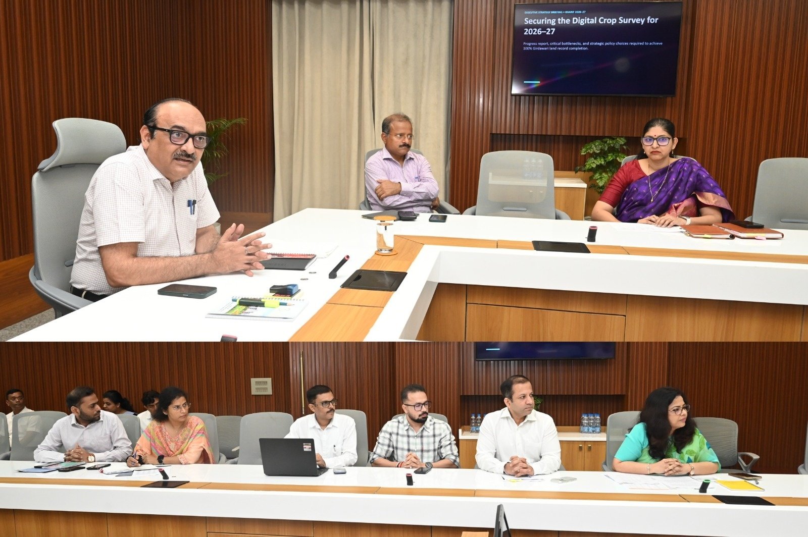
Chhattisgarh Chief Secretary Vikas Sheel chairs a high-level review meeting on the Digital Crop Survey at Mahanadi Bhawan Secretariat on Friday, October 9, 2026 directing officials to ensure 100 per cent girdawari, undertake field-level cross-verification and resolve land mapping discrepancies. Senior officials from the Revenue, Agriculture, Food and other departments attended the meeting. Photo: primelookindia.com via CG/DPR.
Chief Secretary directs district-level verification, cross-checking of crop records with farmer registrations and paddy procurement data, and technological solutions to eliminate mapping errors and strengthen transparency in agricultural administration.
Key Highlights
- Chief Secretary Vikas Sheel directs officials to ensure 100 per cent girdawari coverage through the Digital Crop Survey.
- State-level teams to conduct field inspections and cross-verification of agricultural land records across districts.
- Digital crop information to be matched with paddy cultivation, farmer registration and procurement records.
- Officials instructed to identify mapping discrepancies, verify land parcels and develop technological solutions.
- Revenue Department to coordinate with district collectors for time-bound completion and regular monitoring.
- Accurate digital records expected to strengthen agricultural planning, transparency and farmer-related services.
Chief Secretary Calls for Complete and Reliable Digital Crop Records
Chhattisgarh Chief Secretary Vikas Sheel has directed officials to achieve complete coverage under the Digital Crop Survey, emphasising that every agricultural land parcel must be accurately verified to establish a dependable digital record of crops cultivated across the state.
Chairing a high-level review meeting at the Mahanadi Bhawan Secretariat on Friday, October 9, 2026, the Chief Secretary examined the progress of the survey, the status of land record verification and the measures required to ensure 100 per cent girdawari.
Girdawari is the process of recording details of crops grown on agricultural land, traditionally undertaken through field inspections and revenue records.
The digital initiative aims to improve the accuracy of this process by linking crop information with verified land parcels and geographical mapping.
Sheel instructed officials to ensure that the digital records reflect actual conditions in the fields rather than relying solely on existing administrative entries.
He emphasised that every relevant khasra, or land parcel record, should be examined to establish whether a crop had been cultivated on the land.
Where cultivation is confirmed, officials must record the crop information using the prescribed digital procedure, including the creation of geographical polygons identifying the cultivated area.
The Chief Secretary made it clear that the objective was not merely to complete the survey numerically but to develop a reliable agricultural database capable of supporting administrative decisions.
Field Verification to Establish Accuracy of Survey Data
Recognising that digital information is only as reliable as its verification process, Sheel directed the formation of state-level teams to inspect selected locations across different districts.
These teams will undertake field verification to determine whether the information entered during the survey corresponds with actual agricultural conditions.
Officials have been asked to prepare detailed reports specifying the number of khasra records examined, the records found accurate and the discrepancies detected.
The reports must also identify errors requiring correction and document the action taken to resolve them.
The Chief Secretary stressed the need for internal checks alongside independent field verification to ensure the quality and credibility of the survey.
This approach is intended to reduce discrepancies between digital entries and ground realities, particularly where incorrect crop identification, incomplete records or mapping errors could affect the reliability of agricultural information.
Crop Survey Data to Be Matched With Paddy Procurement Records
One of the major directions issued during the meeting concerned the cross-verification of digital crop survey information with other agricultural databases.
Sheel instructed officials to compare survey findings with records relating to paddy cultivation, farmer registration and government paddy procurement.
Chhattisgarh’s agricultural economy is closely associated with paddy cultivation, making accurate information about cultivated land particularly important for procurement planning and related administrative processes.
Differences between crop survey records and farmer registration databases can arise from incomplete entries, outdated land information or errors in recording cultivation details.
The Chief Secretary directed the departments concerned to identify such discrepancies and undertake necessary corrections.
Comparative verification is expected to help establish greater consistency between agricultural records maintained by different government departments.
It could also support more accurate planning of procurement arrangements, although the effectiveness of these improvements will depend on the quality of field verification and subsequent data updates.
Technological Solutions Needed to Resolve Mapping Errors
The meeting also examined technical difficulties encountered during the implementation of the Digital Crop Survey.
Among the issues identified were the non-availability of certain land maps, inaccuracies in existing mapping information and other technical obstacles affecting survey completion.
Sheel instructed the Revenue Department to develop appropriate technological solutions rather than allowing unresolved mapping problems to delay the exercise.
He called for an action plan to update maps wherever necessary and ensure that the digital survey could proceed according to the prescribed procedure.
The Chief Secretary also emphasised the importance of physical verification and polygon-based validation in cases requiring additional scrutiny.
Polygon mapping enables the geographical boundaries of a land parcel or cultivated area to be digitally represented, helping officials associate crop information with specific locations.
However, such mapping must be supported by accurate land records and field-level confirmation to prevent discrepancies.
By addressing mapping difficulties systematically, the administration aims to improve both the completeness and reliability of the agricultural database.
District Collectors to Review Progress and Resolve Bottlenecks
The Chief Secretary directed Revenue Department officials to organise review meetings with district collectors to assess the progress of the survey and related verification work.
He instructed district administrations to ensure that records relating to villages, agricultural fields and individual land parcels are examined carefully.
Any shortcomings identified during the process must be addressed through time-bound corrective action.
Regular monitoring, coordination between departments and prompt resolution of technical problems were identified as essential requirements for completing the exercise effectively.
The Chief Secretary also stressed that officials at different administrative levels must work in coordination to prevent delays and duplication of efforts.
District-level supervision is expected to play an important role in identifying areas where survey coverage remains incomplete or additional verification is required.
Why Accurate Digital Crop Records Matter to Farmers
Reliable agricultural records have implications beyond routine revenue administration.
For farmers, discrepancies in land or crop information can create difficulties when accessing services that depend on verified agricultural details.
Accurate digital records can potentially support more transparent administration of farmer registration, crop-related assistance, agricultural planning and procurement systems.
They can also help government agencies understand cultivation patterns and identify changes in land use.
However, the benefits of digitisation depend on the accuracy of the information entered into the system.
A digitally recorded error can remain an administrative problem unless there are effective mechanisms for identifying and correcting it.
The Chief Secretary’s emphasis on field verification therefore addresses a fundamental requirement of digital governance: technological systems must reflect verifiable conditions on the ground.
Digital Agriculture Requires Coordination Between Departments
The Digital Crop Survey involves information relevant to several departments, including Revenue, Agriculture, Food and Civil Supplies, and Land Records.
Each maintains information serving different administrative purposes, but inconsistencies between these databases can complicate planning and implementation.
The directions issued during the meeting seek to improve coordination by encouraging departments to compare records, identify differences and undertake corrections.
This integrated approach can contribute to a more dependable information system for agricultural administration.
It also reflects the growing importance of technology-based governance in managing complex public programmes involving large numbers of beneficiaries and extensive geographical coverage.
For a predominantly agricultural state such as Chhattisgarh, reliable land and crop records are particularly important to the functioning of rural administration.
Senior Officials Attend Review Meeting
The meeting was attended by Principal Secretary to the Chief Minister and Energy Department Subodh Kumar Singh; Food and Civil Supplies Secretary Reena Babasaheb Kangale; Agriculture and Farmers’ Welfare Secretary Siddharth Komal Pardeshi; Revenue and Disaster Management Secretary Shammi Abidi; Director of Industries Prabhat Malik; Director of Land Records Vineet Nandnawar; Director of Food Fariya Alam Siddiqui; and other senior officials.
The participation of officials from multiple departments reflected the interdepartmental nature of the Digital Crop Survey and the need for coordinated implementation.
From Digital Entries to Dependable Agricultural Governance
The Chief Secretary’s directions place particular emphasis on the distinction between completing a survey and ensuring that the information collected is accurate.
Achieving 100 per cent girdawari will require not only comprehensive coverage of agricultural land but also consistent verification, updated maps, reliable data entry and timely correction of errors.
The proposed cross-verification with paddy cultivation, farmer registration and procurement records is intended to strengthen confidence in the information maintained by the government.
As Chhattisgarh expands the use of digital systems in agricultural administration, the quality of field-level information will remain central to their effectiveness.
The real measure of the Digital Crop Survey’s success will be whether every recorded field, crop and land parcel accurately reflects conditions on the ground and helps deliver more dependable services to farmers.

YOU MAY LIKE THIS